GPS Visualiser
Adjusting GPS Driving Path
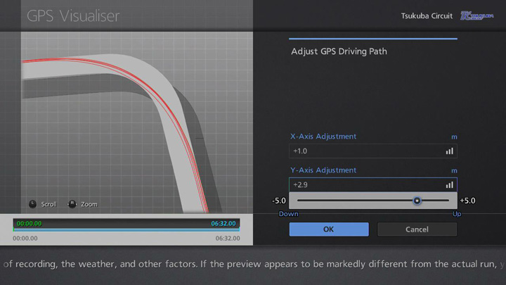
Small errors in GPS data can occur due to the position of the satellites at the time of recording, the weather, and other factors. If the preview appears to be markedly different from the actual run, you can select "Adjust GPS Driving Path" to tweak the line in both the horizontal and vertical planes.
Adjustments should be made so that the driving line displayed on the track map to the left matches more accurately the real line taken. Select "X-Axis Adjustment" and a slider will be displayed, allowing you to move the line left or right. In the same way, the slider that appears when you select "Y-Axis Adjustment" allows you to move the line up or down. You can use the right stick to adjust the level of zoom, and the left stick to scroll around the track map in order to make adjustments more easily.
Some driving line discrepancies may not be possible to remedy solely by adjusting the line in this way. In such cases, you may also need to use the Auto-Fit function.

- © 2016 Sony Interactive Entertainment Inc. Developed by Polyphony Digital Inc.
Manufacturers, cars, names, brands and associated imagery featured in this game in some cases include trademarks and/or copyrighted materials of their respective owners. All rights reserved. Any depiction or recreation of real world locations, entities, businesses, or organizations is not intended to be or imply any sponsorship or endorsement of this game by such party or parties. "Gran Turismo" logos are registered trademarks or trademarks of Sony Interactive Entertainment Inc.
